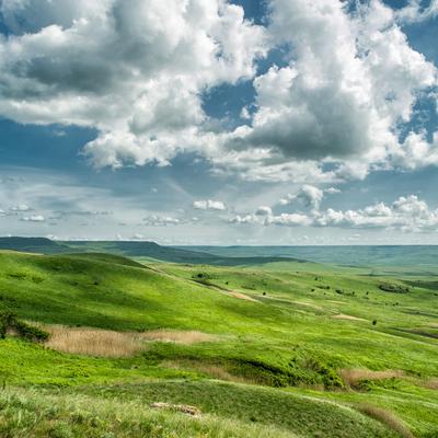
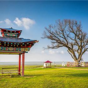
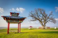
Lone Poplar is the winner of the Russian Tree of the Year competition in 2019.
This poplar is considered a sacred tree by Kalmyks Buddhists. It is surrounded by eight Buddhist stupas. Every year, monks from the Central Khurul perform a large prayer service here. One of the 10 Kalachakra Stupas in the world, the Kalachakra Stupa of Green Tara, the only one in Russia and Europe, is installed here. According to legend, this poplar was planted in the early 20th century by a Buddhist monk.
He brought the seeds from Tibet, where he made a pilgrimage. The monk put the poplar seeds in a traveling staff and buried them on the highest point of the hill in the endless steppe, not far from the springs with healing water. It is difficult to find shady places in the steppes of Kalmykia. A lonely poplar turned into a gigantic tree with spreading branches, casting a thick shadow. Everyone who made long marches stopped here to rest, recited mantras, and turned to poplar with requests. And wishes were fulfilled. So the "Lonely Poplar" began to be revered in Kalmykia as a shrine.
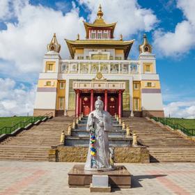
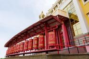
Hurul Syakyusn-Syume.
This place is sacred to the Kalmyks, since the restoration of the Buddhist faith in the republic after the Soviet era of oblivion began from here. Syakyusn-syume (kalm. Sakusn-sum) is a Buddhist temple in the Republic of Kalmykia. Khurul is located six kilometers from the capital of Kalmykia, near the village of Arshan. The official name of this religious building is "Geden Sheddup Choikorling", which literally means "The Holy Monastery of the theory and practice of the Gelug school" in Tibetan, and loosely translated – "The Holy Monastery of Enlightened monks".
This name was bestowed by His Holiness the Dalai Lama XIV in advance, even before the construction of the temple, in 1992. This place was consecrated in 1992 by the Dalai Lama XIV himself during his second visit to Kalmykia, and four years later the "Shakyusn-Syume" hurul was erected on this site. In 2004, the Dalai Lama visited Kalmykia and Elista for the third time, in order to hold the radne ceremony, after which hurul rightfully became a real abode of deities. You can see where the monks live, there is a small house nearby, in which the Dalai Lama XIV bestowed Teachings to the Buddhists of Kalmykia and Russia.
N. N. Palmov National Museum of the Republic of Kalmykia (1 hour).
The National Museum of the Republic of Kalmykia named after N. N. Palmov is the main museum of local lore of the Kalmyk people. It is located in Elista, the capital of the republic, and presents expositions dedicated to the nature of Kalmykia, various periods of history, ethnography, beliefs, as well as outstanding people of the republic, in short, everything that makes up Kalmykia. Named after one of the founders of Kalmyk local lore, historian Nikolai Nikolaevich Palmov, the museum is both an important tourist attraction and the pride of the inhabitants of the region.
The museum was established on March 25, 1921 at the Archive and Museum section of the Department of Education. The exposition was based on collections collected by historical scientists Nikolai Nikolaevich Palmov and Pavel Sergeevich Rykov. Nikolay Palmov headed the joint section. At the end of the year, the museum and the archive were separated, and Nikolai Nikolaevich remained in charge of the archive.
The museum was opened to the general public only in 1931. At that time, he occupied two small buildings on Suseev Street.
During the Great Patriotic War, the inhabitants of Kalmykia had to endure two serious trials: the deportation of the Kalmyks from their own republic in 1943 and the occupation of Elista by the Germans, as a result of which the museum and the entire exposition were destroyed. The fact is that when Kalmykia was occupied, according to the country's leadership, collaboration among the population was strong in the republic (conscious cooperation with the enemy). It was decided to deport the Kalmyks after the liberation of the territory of the republic as a "punishment" for the entire Kalmyk people. Which was carried out in 1943. Chechens and Ingush, for example, suffered the same fate. However, many historians agree that the level of collaboration among the Kalmyks was no higher than the national average.
The Kalmyks were allowed to return from deportation only in the late 50s. Shortly after that, on January 1, 1960, the second opening of the museum took place.
Now the National Museum of Kalmykia occupies a new building on Dzhangara Street.
Khosheutovsky khurul in the village of Rechnoye.
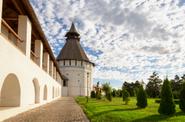
Khosheutovsky, or Bolshoy Tyumenevsky, khurul is the only pre—revolutionary Buddhist temple in Kalmykia that has partially survived to the present day. It is the oldest Buddhist temple in Europe.
Khurul is located in the village of Rechnoye, which is now in the Astrakhan region, since the territories of two districts of the former autonomous Kalmykia after the forced deportation of Kalmyks to the eastern regions of the USSR (1943-1957) were not included in the restored republic, but remained in the Astrakhan region. The founder of khurul was Prince Serebjab Tyumen, a hero of the Patriotic War of 1812, an outstanding military commander who headed the Second Astrakhan Kalmyk Regiment, the owner of the Khosheutovsky ulus. The authors of the project were his brother Batur-Ubushi Tyumen (a warrior, historian and writer) and the Buddhist monk Gavan Jimbe.
In the summer of 1814, the brothers visited St. Petersburg, where they participated in the celebrations on the occasion of the victory over Napoleon. Inspired by the greatness of the city, especially the Kazan Cathedral, which has become a monument of Russian military glory, they decided to perpetuate the memory of the victory in their native steppes. It is believed that this is how the idea of building a stone temple was born. In the 20s of the XX century, the Khosheut khurul was closed. In the 30s of the XX century, khurul was used as a club, in the 50s it was used as a granary.
After the restoration of the Kalmyk ASSR in 1957, the territory on which the Khosheutovsky Khurul was located was transferred to the Astrakhan region. In the 60s, most of the khurul was dismantled for the construction of a cowshed. Later, the remaining part of khurul was abandoned, and it gradually began to collapse.
Ancient photographs stored in museums and archives indicate that the Khosheut khurul was a majestic ensemble consisting of a central three-nave tower (syume) and two galleries extending from it in a semicircle and ending with two small towers (swell), as well as several outbuildings and a stone fence on brick pillars. The three—nave main tower is the only thing that has survived from khurul now.
The cultural and historical complex "Sarai-batu", "The Sacred Palace".
In the first half of the XIII century, at the behest of Khan Batu (Batu), grandson of Genghis Khan, a nomadic headquarters appeared here. Gradually, the small settlement turned into the capital of the Golden Horde, a major commercial and political center: at its peak, 75,000 people lived in it (for comparison, the population of London was about 50,000 at that time, and Paris was 25,000— 30,000 people). However, the city differed not only in size, but was also well-maintained. Already in the Middle Ages, water supply and sewerage systems operated here, and there was a whole system of public free baths and toilets. The first extant mention of Sarai Batu dates back to 1254, when it was visited by Guillaume de Rubrouck, ambassador of the French King Louis IX.
In the middle of the XIV century, civil strife began in the Golden Horde, the state and, accordingly, its capital weakened. New troubles befell Sarai-Batu when Tamerlane, passing through the Lower Volga in 1395, destroyed almost all the Golden Horde cities. And although the city itself escaped destruction, it became increasingly difficult to live in it, and therefore the population gradually began to leave Sarai al-Mahrusa.
By the XV century, life here had almost stopped. And in the XVI century, the construction of the Astrakhan Kremlin began — it was decided to use a square brick (plinth), which was used in the construction of the Golden Horde buildings. As a result, a significant part of the city was dismantled.
In 1710, by decree of Peter the Great, a plant was built here for the extraction and processing of saltpeter, which was required for the manufacture of gunpowder. When, by the end of the XVII century, the saltpeter reserves ran out and the plant was closed, the settlement that formed around it remained — former factory workers and runaway peasants lived here. Since then, it has been listed on maps as the village of Saltpeter.
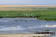
Excursion to the Bogdinsky-Baskunchaksky Nature Reserve (2.5-3 hours).
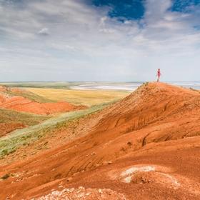
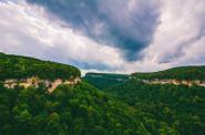
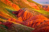
Big Bogdo Mountain. The highest point of the Caspian lowland. It appeared out of the ground, as if from nowhere, and is a huge salt dome covered with ancient clays, sandstones and limestones. Some deposits are over 200 million years old. This is the only mountain in the world whose height, thanks to the salt dome, is steadily increasing.
Bolshoe Bogdo Mountain is a unique creation of nature not only in the Caspian lowland, but also in the entire Russian plain. She brought to us the remains of the Mesozoic era in a petrified state. In the cliffs of the mountain there is a marine Triassic with fossilized remains of animals that lived 200-250 million years ago. There is a cave labyrinth under the mountain – unique karst caves. Surprisingly, the mountain rises on an almost perfectly flat plain – arid, covered with sagebrush-solyanka semi-desert vegetation. The color of the mountain is also unusual, it varies depending on the season and time of day.
Bolshoe Bogdo Mountain is a special, sacred place for the Kalmyk people. According to legend, Mount Bogdo was formed from a sacred stone brought by Kalmyks-pilgrims from the distant Tien Shan mountains. The mountain is guarded from uninvited intrusion by the White spirit of Lake Baskunchak, who really dislikes when idle people come to him, and drives them away with angry muttering. Even with moderate air movement at night, an indistinct hum can be heard here, really resembling a murmur. In a strong wind, resonating in the voids, the mumbling turns into a shrill howl and intermittent whistling.
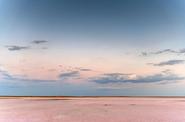
Baskunchak Lake.
It once formed part of a huge ancient sea, which included the Aral, Black, and Azov Seas. This ancient sea flooded the territory of modern Kazakhstan and Turkmenistan with its waters, reached almost to the Tien Shan Mountains, stretched west to the Middle Danube Lowland and north to the present Saratov region. Baskunchak is not a lake, but a solid layer of salt, having a domed shape and extending its base into the bowels of the earth. The lake is just a small "abrasion" on the top of this salt mountain.
The outline of the "abrasion" resembles a diamond with rounded corners. The long axis of this rhombus extends from southeast to northwest for 19 km, the short one is directed from west to east and has 9 km. The length of the edges is an "abrasion" on the huge body of a salt monolith weighing hundreds of billions of tons, hidden by the hands of nature under a thick layer of sedimentary rocks. The bottom of the lake is solid salt. There are deposits of medicinal clays on the shore of the lake. In June and August, tourists come to the lake, who swim in brine and take mud baths. Therapeutic air with a high content of bromine and phytoncides, sulfide silt mud, similar in action and composition to Dead Sea mud, sodium chloride brine containing a complex of macro- and microelements, contribute to rapid recovery.
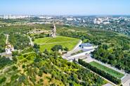
Mamayev Kurgan was mentioned during the battles for the city as the height of "102.0". Possession of this height led to domination over the central part of the city, so it became the main height of Russia. The three days from September 13 to September 15 were critical for the defenders of Stalingrad: German troops managed to capture most of the city, including Mamayev Kurgan. In the last few hours, a turning point has come. Quite unexpectedly, the Nazis launched a counterattack by the new 13th Guards Rifle Division of General A. I. Rodimtsev from the Stavka reserve. After crossing the Volga, she immediately attacked the enemy and recaptured Mamayev Kurgan on September 16. Thanks to such counterattacks by Soviet troops, mass heroism and the struggle for every house, the further advance of the fascists was stopped.
The opening of the largest war memorial in the USSR took place on October 15, 1967, when the city was already called Volgograd. Twice a year, the memorial complex becomes a place of pilgrimage for Russian and foreign tourists. Two Victory Days are celebrated here – February 2 and May 9.
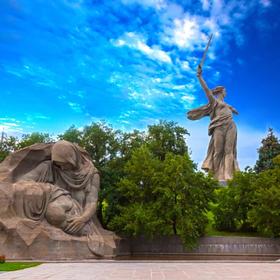
The sculpture "Motherland Calls" symbolizes the call of the Motherland – to rise up for the whole people to achieve victory in the Great Patriotic War. The Motherland turned to face the east, a sword in her right hand. The massive sculpture stands loosely on the base, like a chess piece on a board. Together with the "stand", the Motherland weighs 8,000 tons. The torso and arms of the 52-meter reinforced concrete sculpture are held in a static position by more than 100 steel cables placed inside. The sword is 32 meters long and weighs 14.6 tons. It is a stainless steel frame sheathed with steel sheets.
The Hall of Military Glory. In the center of the hall there is a 5-meter sculpture of a hand holding a torch with the fire of Eternal glory. The changing of the guard takes place every hour.
A ramp along the wall spirals up to the exit, which is on the same level as the Square of Sorrow. There is a sculpture of a mother grieving for her murdered son. His face is covered with a banner.
The sculpture "Not a step back!" greets visitors to the memorial complex. It is installed in the middle of a circular pool. The appeals of the war years "Not a step back!" and "Stand to the death!" are scratched on the concrete mass of the sculpture.
Heroes' Square consists of six sculptural compositions depicting ordinary defenders of Stalingrad – soldiers, sailors, orderlies.


