Difficulty category: 1 difficulty category of the tourist route.
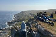
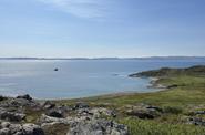
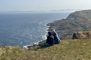
The subjects of the Russian Federation on whose territories the tourist route passes: Murmansk region.
Duration of the tourist route: 9 days.
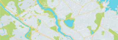
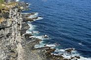
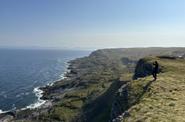
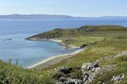
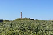
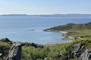
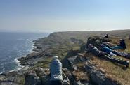
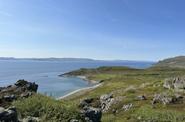
Description of the tourist route (route option): from the village. Bolshoe Ozerko (nezhil.) – Zapadnaya Maika river – R. Pyave – Zubovka (nezhil.) – Tsypnavolok – Anikiev river – M. Korabelny – R. Korabelny – Eina – Rokopakhta – Cape Litke – P. Bolshoe Ozerko (nezhil.).
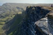
The maximum height difference on the tourist route is 368 meters.
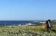
The seasonality of the tourist route: summer hiking – the second half of June, July, August, September.
The starting point of the tourist route (coordinates): The start of the route is N69°44'15.9516" E32°09'17.8843".
The place of completion of the tourist route (coordinates): The end of the route is N69°43'51.9814" E32°09'17.9406".
The length of the tourist route (m, km): 121 km.
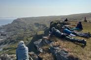
Places of proposed overnight and rest (coordinates):
- Overnight stay 1 N69°45'53.4549" E32°19'18.3380".
- Overnight stay 2 N69°47'42.6627" E32°28'22.7554".
- Overnight stay 3 N69°45'52.8710" E32°50'31.2452".
- Overnight stay 4 N69°42'30.4359" E33°04'27.0753".
- Overnight stay 5 N69°37'19.4139" E33°00'28.3974".
- Overnight stay 6 N69°34'56.0574" E32°45'01.5665".
- Overnight at 7 N69°38'22.7455" E32°25'10.0992".
- Overnight 8 N69°43'03.0894" E32°10'06.8769".
Emergency exit routes from the tourist route:
- To the proposed camp No. 4 near the village of Zubovka (nezhil.) – an emergency exit is carried out along the Titovka – Eina road, followed by an exit to the village.Titovka (red thread on the map).
- After passing through Camp 4, an emergency exit is carried out along the route toTitovka (red thread on the map).
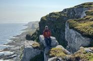
Description of the obstacles on the tourist route.
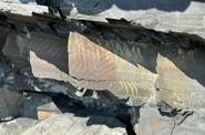
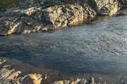
Type of obstacle: Ford crossing b/w. Zapadnaya Maika river (cat. 1A) - A simple crossing – across rivers with a width of at least 10 m or a depth of at least 0.6 m, overcome individually with some difficulties, the "wall" is easy to pass. Height of the point (depth of immersion), m: 0.7.
Type of obstacle: Ford crossing in the north of the Pyaiva River (cat. 1A) - A simple crossing – across rivers with a width of at least 10 m or a depth of at least 0.6 m, overcome individually with some difficulties, the "wall" is easy to pass. Height of the point (depth of immersion), m: 0.8.
Type of obstacle: Ford crossing b/w of the Anikiev River (cat. 1A) - A simple crossing – across rivers with a width of at least 10 m or a depth of at least 0.6 m, overcome individually with some difficulties, the "wall" is easy to pass. Height of the point (depth of immersion), m: 0.6.
Type of obstacle: Ford crossing b/w Korabelny river (cat. 1A) - A simple crossing – across rivers with a width of at least 10 m or a depth of at least 0.6 m, overcome individually with some difficulties, the "wall" is easy to pass. Height of the point (depth of immersion), m: 0.75.
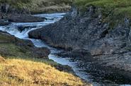
Type of obstacle: Top slope ofEina - simple grassy and talus slopes with a steepness of up to 30 degrees (1A).
Type of obstacle: Crossing the Ford of the b/w of the Eina River (cat. 1A) - At least 300 m of elevation difference, movement is hindered by scree, vegetation, and light rocks. Height of the point (depth of immersion), m: 300 m.
Improvement of the route of the tourist route: none.
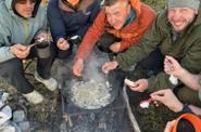
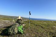
The list of individual and group equipment, including personal protective equipment, necessary for the passage of the tourist route: group: awning, boilers, burners; individual: tent, sleeping bag, mat, backpack, trekking poles.