07:30 Breakfast.
08:00 Transfer to the pier.
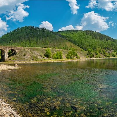
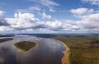
Departure to Putorana Plateau, Lama Lake. The Norilsk River, or Norilka, flows in the Taimyr Dolgano-Nenets region. The length is 57 km. The bridge over the Norilka River is noted in the UNESCO collection "Bridge Building of the World" as "the northernmost of the large bridges in the world beyond the 69th parallel."
Lakes Melkoe, Lama, Keta, Glubokoe, Sobagye, Nakomyaken and numerous small lakes in the tundra play a regulatory role in the river's water regime, smoothing out floods.
Next, our path lies along the Talaya River, climbing up to the island of Melkoe, which is located about 25 km east of Norilsk. The lake is located in a wide basin between the western spurs of the Putorana plateau.
The lake is connected to Lake Lama by the Strait or, as the locals call it, the Lama River (Lamochen), 18 km long.
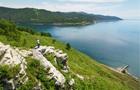
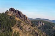
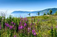
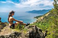
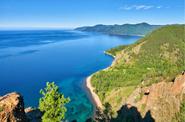
Here is the famous Lama Lake – northern Switzerland, Taimyr Baikal, polar Ritsa. This is perhaps the most beautiful and famous lake in Taimyr. According to scientists, the lake is about 100 million years old. The lake stretches for 80 km, while its width is not more than 14 km.
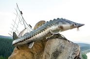
There are about 20 species of fish in the lake: muksun, taimen, whitefish, grouse, nelma, burbot, etc. By the way, the same name – the Lama – Evenks, who lived much further south, called Baikal.
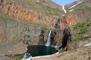
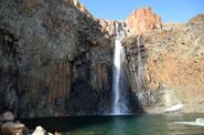
Excursion to the waterfall "Yuzhny Neralakh" (the route length is about 2 km. one way). The waterfall is no more than 50 m high. It is one of the most beautiful waterfalls of the Putorana plateau. The walking accessibility of the waterfall allows a large number of tourists of all ages to admire such a natural phenomenon.
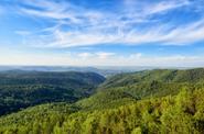
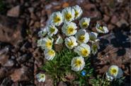
The trail to the waterfall passes through a charming tundra area filled with shrubs of rosemary, juniper, alder, blueberry, lingonberry, polar willow, dwarf birch and many other vegetation. Large stones are covered with colorful tundra moss.
Lunch (lunch box).
Kapchuk Lake tour is a small lake of tectonic origin surrounded by rocky mountains.
Climb to the observation deck, which offers stunning views of two fjord lakes: Lama on the right, Kapchuk on the left (the route length is about 2 km. one way, easy ascent).
Return to Norilsk.
Transfer to the hotel.
A late dinner.