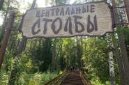
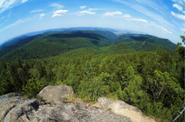
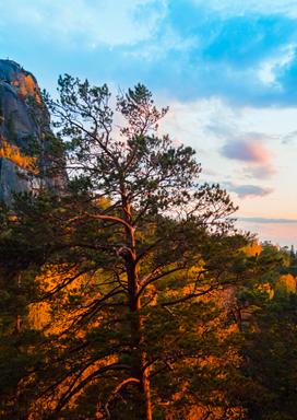
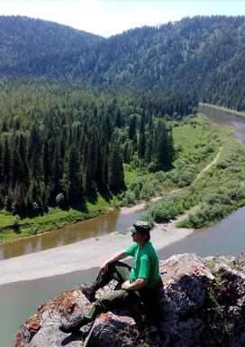
1. Stolby Nature Reserve - the natural boundaries of the protected area are the right tributaries of the river. Yenisei: in the northeast is the Bazaiha River, in the south and southwest are the Mana and Bolshaya Sluznevka Rivers. From the northeast, the territory borders with the city of Krasnoyarsk. The reserve was founded in 1925 on the initiative of the residents of the city to preserve the natural complexes around the picturesque syenite remnants — "pillars". Currently, its area is 47,219 hectares. The main attraction of the reserve are the rocks.
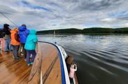
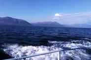
2. Kazachinsky threshold is the most impassable section on the Yenisei near the village of Kazachinsky (233-240km from Krasnoyarsk). Its length is 4km. It is formed by rocky ledges, rocky ridges of the Yenisei Ridge, crossing the riverbed along its entire width. The vessels are conducted upstream by the only special motor ship in Russia, the Yenisei tourer, moving by stretching a cable laid along the bottom of the river. The Yenisei riverbed narrows to 350m at the threshold, and the ship's passage is up to 70m. But how beautiful the Cossack threshold is, for all its severity! Many artists have repeatedly painted his views. The threshold originates at Kamenny Cape. The water in the Yenisei is noisy and foaming at the rocks. The high hills of the river banks fascinate with their beauty, beautiful rocks are visible, ending at the water's edge, for example, the Eagle rock on the left bank. On the right bank there is an amazingly beautiful island called Islets, and behind it the picturesque Zaostrovskaya bayou.
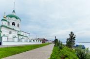
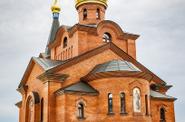
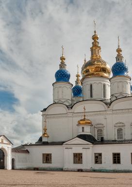
3. Yeniseisk is located on the Yenisei plain, on the left bank of the Yenisei, below the confluence of the Angara River, 330 km north of Krasnoyarsk. The city of Yeniseisk is called an "open-air museum", the urban development includes 94 architectural monuments. The complex of the Transfiguration Monastery and four churches are unique examples of Siberian Baroque, built in the middle and second half of the XVIII century. They are close to the Russian temples of the previous century in terms of planning and spatial structure and picturesque decor. The stone civil buildings of Yeniseisk are mainly two–storey houses along the main street, on the embankment and central squares.
4. Osinovsky cheeks is the most picturesque area in the lower reaches of the river. The high granite banks form a corridor with a height of 50 m. After 20 km from the threshold, two islands appear around the bend. The first one looks like a ship. Covered with sparse fishing line and with a single pine tree on top, it is called "The Island of the Ship". It rises 50 m above the water. Beyond it, 150-200 m away, is the island of Barochka.
5. The village of Bor is located on the left bank of the Yenisei, 3 km below the mouth of the Podkamennaya Tunguska River. The modern history of the village began in 1946, immediately after the Great Patriotic War, with the construction of an airport on the left, high and steep bank of the Yenisei, opposite the mouth of the Podkamennaya Tunguska River. The dual-use airport was a strategic transport center, located almost exactly in the center of the USSR and Russia. An air defense military unit was located on the territory. Then the village became the center of geological exploration expeditions. The border of the Central Siberian Reserve is located from the village of Bor at a distance of 60 km, where the first stronghold, the Koms cordon, is located. The administration of the Central Siberian Biosphere Reserve is located in the village of Bor.
6. Turukhansk is located at the confluence of the Lower Tunguska with the Yenisei, 1,474 km north of Krasnoyarsk. The population is 4.8 thousand inhabitants. Founded in 1607 as a winter quarters, since 1619 it has been inhabited by settlers of the burnt-out city of Mangazeya. The former Turukhansk became the village of Staroturukhansk, and the modern village with the name Turukhansk (the administrative center of the district) was previously named Novoturukhansk. In the 19th and 20th centuries, it was a place of exile (including I. V. Stalin in 1914-1916). The attraction of the village is the Trinity Church (late 18th — early 19th century). In Turukhansk there is a fish factory, an oil and gas exploration expedition, a river port, an airport, a museum of revolutionaries Y. M. Sverdlov and S. S. Spandaryan. Here you will see the right tributary of the Yenisei - the Lower Tunguska. In the 17th century, Russian explorers named the river Nizhnyaya Tunguska. Tunguska – because Tunguska (modern Evenki) lived on its shores, and the definition of Nizhnyaya distinguished it from the other two Tunguska.
7. Igarka is a city located on the shore of the Igara Bayou of the Yenisei, 1,330 km north of Krasnoyarsk. It is located beyond the Arctic circle, in the permafrost zone. It got its name from the channel on which it was located, and that, in turn, was named after the local fisherman Egor Shiryaev, whose name the locals turned from "Egorka" into "Igarka". Now it is a port accessible to ships from the Yenisei Bay, there is also Igarka Airport, used for transporting cargo and work shifts to oil fields.
8. The Taimyr Museum of Local Lore celebrated its 80th anniversary on September 4, 2017. The museum's collections contain tens of thousands of objects that witnessed vivid events in the life of our region and the country. The staff of the Taimyr Museum of Local Lore regularly replenish the personal archives of outstanding people of our territory who have made an invaluable contribution to the development of Taimyr. People who study its unique nature, historical past, and popularize the unique culture of indigenous small ethnic groups. The museum's exposition occupies an area of 1172.5 sq.m. and is located on three floors. The first floor is occupied by the museum's art collections: paintings, graphics, decorative and applied arts, thematic exhibitions from the funds of the Taimyr Museum, as well as exhibitions from private collections and other museums in Russia. The second floor is occupied by the exposition "Man and Nature", with a total area of 376.8 sq.m. This section of the museum's exposition introduces visitors to the extremely complex and multifaceted natural world of Taimyr and the culture of the indigenous peoples – Nganasan, Ents, Nenets, Dolgan, Evenks. The Taimyr Museum of Local Lore is the keeper of unique collections, which have no analogues in any museum in the world. These are, first of all, shamanic costumes, cult objects of Nganasan and entsevs. The historical section of the exposition is located on the third floor. In 2012, a unique mammoth skeleton was found in the Taimyr tundra. The mammoth Zhenya, named after the boy Eugene Salinder, who discovered it in the soil of the Sopkaginsky Cape, has become a truly priceless exhibit of the Taimyr Museum of Local Lore, since there are no paleontological artifacts of similar importance in any museum in the world.
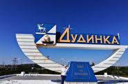
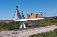
9. Dudinka is the coldest (rarely, but it happens up to -57 ° Celsius) and the northernmost (69°21' s) city on the planet. It is located on the right bank of the river. The Yenisei River at the confluence with the Dudinka River, named after the first Russian artisan Dudin, who settled here in the first half of the XVII century, just above the mouth of the river. And the city got its name from the name of the Dudinka river. According to another version, the name of the city came from the Russian transcription of the Evenk words "dugin" (channel, island between channels, mouth of the channel) and "dugu" (cape of the river). The accusative case of the word "dugin" sounds like "duginma". And finally, according to the third version, from the Russian transcription of the word Encev—somatov (in the XVI - XVII centuries they roamed in the area of modern Dudinka and adjacent areas along the right and left banks of the Yenisei) "kaduta" ("purple place") — that's what they called the place on the high right bank of the Yenisei, where Dudinka now stands. "Before Dudinka," writes F. Nansen — a hill rises, covered with sparse low-growing forest. This was the first hill we encountered up the Yenisei..." (He sailed from Dixon in the navigation of 1913 – L. N.).
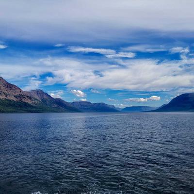
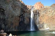
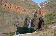
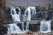
10. The Putoransky State Nature Reserve (1,887,251 hectares, established in 1988), which is located on the border of the Taimyr and Evenki Autonomous Okrugs of the Krasnoyarsk Territory, has been declared a World Heritage Site. The reserve occupies the central – the most elevated – part of the vast and almost untouched by civilization Putorana plateau. The peripheral, lower areas of this plateau, adjacent to the reserve from the west, north and east, have the status of its buffer zone; this "semicircle" is recognized at the same time as the buffer zone of the World Heritage Site. The Putorana plateau is a unique natural complex in terms of picturesqueness, with the highest concentration of waterfalls and mountain lakes, even by world standards, including extremely exotic – narrow, long and deep "fjord lakes", as well as a whole complex of high flat-topped massifs separated by deep and wide stepped canyons. Lama Lake – northern Switzerland, Taimyr Lake Baikal, polar Ritsa. This is perhaps the most beautiful and famous lake of Taimyr. Even his name is similar to the rest of the northern hydronyms. The lake is located in a deep mountain depression. Its basin is of tectonic origin. According to scientists, the lake is about 100 million years old. The name of the lake comes from the Tungusic-Manchurian word "laamu" - sea, ocean; Evenk "lamu" - sea, big water. By the way, the same name – Lama – Evenks, who lived much further south, called Baikal.
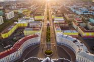
11. Norilsk got its name from the name of the area where it is located: the Norilsk River (Norilka) flows near the city (Pyasina River basin), the city itself is located near the Norilsk Mountains. Travelers Khariton Laptev, A. F. Middendorf, F. B. Schmidt mention the Norilsk River and the Norilsk Mountains in their reports. There are many versions of the origin of the name of the Norilka River. According to one version, the name of the river came from the word "norilo" — a long thin pole that stretched the bowstring of the shutter nets under the ice from hole to hole, according to another - the name of the river and, accordingly, the city comes from the Evenk word "narus" or Yukaghir "nyoril", which means "swamps". Today, Norilsk is an industrial city with a rich history, the city-forming enterprise "Norilsk Nickel".


