The subjects of the Russian Federation on whose territories the tourist route passes: Murmansk region.
Duration of the tourist route: 7 days.
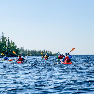
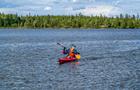
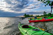
Description of the tourist route (route option): Revda village – beach on the shore of the Umbozer 1.5 km south of Pesochnaya Bay – beach on the shore of the Umbozer 1.3 km north of the Tavayok River – trekking to Lake Sengisyavr – Umbozer traverse from east to west to the mouth of the Tuljok River – trekking to Mount Koashkar or Chivrnyun – crossing to Cape Litt – crossing to Cape Golodny – Revda village.
The maximum height difference on the tourist route is 610 meters.
The seasonality of the tourist route: summer hiking – the second half of June, July, August, September.
The starting point of the tourist route (coordinates): 67.888798, 34.347048.
The place of completion of the tourist route (coordinates): 67.888798, 34.347048.
The length of the tourist route (m, km): 90 km.
Places of proposed overnight and rest (coordinates): Overnight stay 1 – 67.84166 34.33303, overnight stay 2 – 67.78047 34.35839, overnight stay 3.4 – 67.76015 34.17774, overnight stay 5 – 67.87971 34.18469. overnight stay 6 – 67.87106 34.29899.
Emergency exit routes from the tourist route: none.
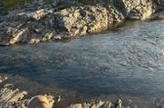
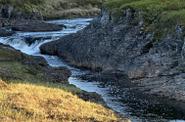
Description of the obstacles on the tourist route: 1) Lake Umbozero – Vodnoe 1 ks – perekat, bystrina, low ramparts, in which there is no need to choose a line of movement and exploration. 2) Climb Koashkar mountain. Simple grassy and crumbly slopes with a steepness of up to 30 degrees.
Improvement of the route of the tourist route: none.
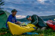
The list of individual and group equipment, including personal protective equipment, necessary for the passage of the tourist route: group: awning, boilers, burners; individual: sea kayak, paddle, helmet, life jacket, tent, sleeping bag, mat, backpack, trekking poles.